HKB 31/973 Evenestangen
- Inka

- Jun 7
- 4 min read

A couple of weeks ago both me and the GirlfriendWife had a few days off work so we loaded up the car with gear and supplies, and went hunting for old German concrete in the form of bunkers and coastal defences.
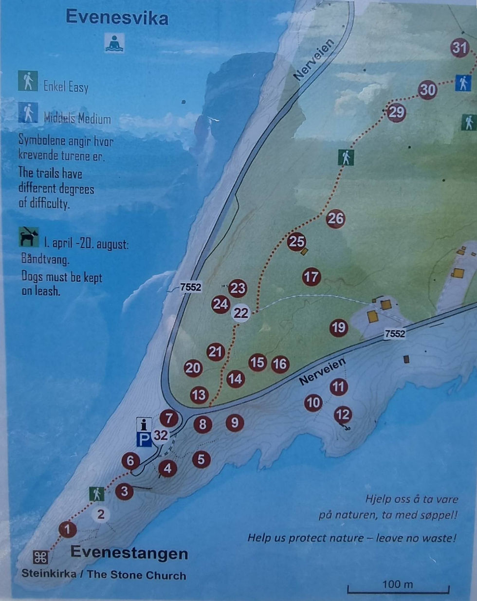
Some three hours drive south, next to Evenes Airport between Narvik and Harstad, was the goal for our journey, a small part of Hitlers Atlantikwall, HKB 31/973 Evenestangen.
The construction began in 1940 and already in June the following year the fort was operational and contiuned to be so until the liberation in May 1945. It was built by Organisation Todt. Some of the workforce came from local entrepreneurs but also a contigent of Soviet POWs was most probably used later on.
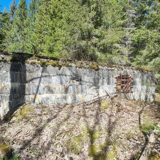
The fort is built from the beachfront and stretches uphill and is stacked with close defense positions, bunkers and rooms and tunnels are going into the mountain.
It was manned by 150 men and armed with three 21cm Mörser 18, which had a maximum range of 16700 meters.
Two smaller guns were also strategically placed on the hill, a 7.62 cm F.K 17(t), and a 3.7 cm Pak.
The close defence consisted of ten stationary flamethrowers ( Abwehrflammenwerfer 42 ), four machinegun positions ( 2x s. MG(n) and 2x le. MG(n) ).
For airdefence were four 2 cm Flak 38 and two searchlights ( 1x 60cm + 1x 150cm Scheinwerfer ).
This Heeres Küsten Batterie sorted under Artillerie Gruppe Narvik, and its Feldpost Nr. was 03 117.
We started driving very early, so in good time before lunch we tumbled out of the car and prepared for a few hours strolling. The weather couldn`t have been better. Sunny and mostly blue sky and 14-15 degrees Celsius, and better yet, the insects still hadn`t arrived for the Bug Fest.
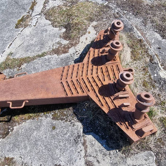
Our exploration began at point one and two on the map, and we worked our way to the top. Around the Mörser position at point # 2 a few bits of gun that had been destroyed after the war were scattered between the beach rocks. Here and there were huge dumps of barbed wire.
There were some Finnish scuba divers preparing to go underwater, and in retrospect I should have asked them what leftovers from the fort lay around there under water, it would be interesting to know.


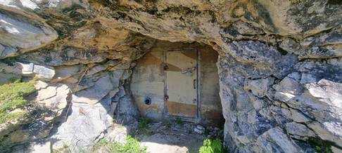
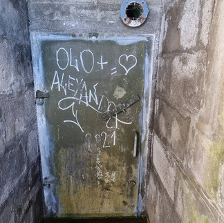
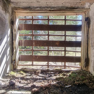
The ammo niches and shelters around the Mörser position were inspected before we found entrances on the face of the mountain shut with Nato type steel doors. One of them was open and inside were wooden shelves. Reading up on this later I found that Nato or perhaps the secret operation "Stay Behind " used parts of the installations at the end of the Cold War.


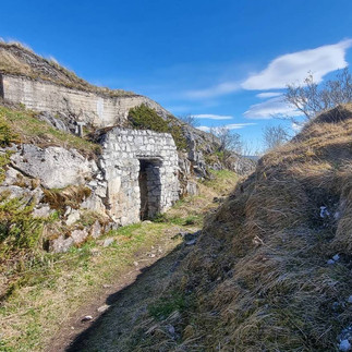
Across the road a light climb begins and along a once well marked trail going up the hill we find position after position. The command bunker is relatively small, and is completely stripped, and covered in old grafitti, but it has a great view.
A few meters above it we find one more of the large kettles for the Mörser together with shelters and ammo bunkers.


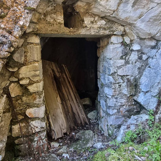
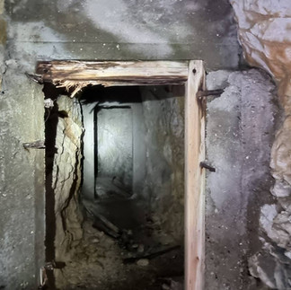
We notice some discrepancies between the numbers on the map from the parking lot and another map I had found online, and investigating this we discover several entrances leading into tunnels and rooms.
From the dust on the floor it looks like its been years since anyone ventured into them and it is really eerie and spooky. I love it.
In one of the entrances leading into a wide, large and long corridor I have to step over a broken door. It looks like it was torn off its hinges decades ago. There is a faint painted text visible on it : Danger! Loose rocks. I glance at the roof and at the floor. Fallen rocks. Then I notice a room to the side of the entrance. Someone had once made a large fire there, and the heat made layers of the roof and walls crumble and fall to the ground.
I didn`t feel like getting buried like a troll today, so we went back out to the sunny surface.


Now we entered a pine forest where the soldiers had lived. There stood the foundations of two large barracks. The first one had a cellar where one of the rooms had metal hooks in the roof, the meat storage.
The other barrack had a large concrete sink with once running water so the soldiers could keep clean.


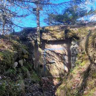
Following the rest of the trail to the top took us past a cable well with remains of a hut nearby, up a stairs made of natural rocks, and on the top we found a Mg bunker with a ringstand, but it was all welded shut. In front of the bunker was a small trench cut into the rock and reinforced with large metal beams.
Here we ate our lunch together with a flock of ants trying to raid our food. We enjoyed the view a while before we brushed off the raiding party and headed back down the hill.


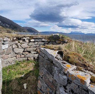
On beach level again, a little to the west of the main trail, were the last positions. A couple of shelters and a trench cut into the rock leading to a Mg position built with rocks from the beach. Here was also the quay the Germans used to bring in equipment.


I hope you enjoyed the stroll around this fortification, and it won`t be long before we`ll visit another interesting site.
Thanks for reading, and have a brilliant week.


Comments